Leilek District (Leylekskiy Rayon)
Leylek (Лейлек району) is a district of Batken Region in south-western Kyrgyzstan. It borders with Batken District in the east, and Tajikistan in the south, west, and north. Its area is 4653 km2, and its resident population was 146,020 in 2021. The administrative seat lies at Razzaqov.
Leylek District is located between the northern slopes of the Turkestan Range and the Ferghana Valley. It contains the lowest point of Kyrgyzstan: 401 meters above sea level.
Leylek District is located between the northern slopes of the Turkestan Range and the Ferghana Valley. It contains the lowest point of Kyrgyzstan: 401 meters above sea level.
Map - Leilek District (Leylekskiy Rayon)
Map
Country - Kyrgyzstan
 |
 |
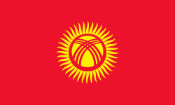
| Flag of Kyrgyzstan | |
Ethnic Kyrgyz make up the majority of the country's 6.6 million people, followed by significant minorities of Uzbeks and Russians. The Kyrgyz language is closely related to other Turkic languages.
Currency / Language
| ISO | Currency | Symbol | Significant figures |
|---|---|---|---|
| KGS | Kyrgyzstani som | Ñ | 2 |
| ISO | Language |
|---|---|
| KY | Kirghiz language |
| RU | Russian language |
| UZ | Uzbek language |


